Thursday, September 1, 2016

0001 COTIJUBA ISLAND WEST COAST
PART 4 TRAILS ALONG COTIJUBA ISLAND’S WEST COAST
(Saudade, Sossego and funda beach

Route along the west coast. Seven Beaches.

First, took the main lane to the west, and walked for about five minutes. Then I reached the Farol beach, along which I walked
For 10 minutes, then along Amor beach for about five minutes. The tide was coming and I took the trail which goes along the beach, past some cottages, till I reached the Saudade beach, after almost two kilometers. Then, I climbed down natural stairs and walked along the beach. Halfway along, I saw  fishing boats.

                        View back of Saudade beach. Fishing boats

After that, I saw another fishing boat on a sandbank. The tide was coming quick. There weren’t much people, except for the fishers.
Although city people are afraid of sting rays in the lagoons, fishers’ children run around and play in the lagoons. There seem to be many myths about the island. Mind you, you can spot bones of stings on the sand. It looks frightening for outsiders.


Fishing boat on the sandbank. Tide coming quick!

Saudade Beach stretches for about 1.900 meters, slightly forming and arch. Behind the dunes, lie small creeks, where fishers catch shrimp. There are also some mangroves, as well as small ponds, some of them, almost inaccessible.


View ahead of the final part of Saudade beach. Wild appearance
The final part of the beach is narrow and stony. The beach is sided by a low-vegetation area, where trees are aligned.  Then you are faced with a higher bank, upon which stands a hut


Stony patch near the end of the beach

Some of the trees are very close to the shore: an evidence that the tide is really in. The shadows of these trees are nice for camping. One can put up his tent here and spend some time.
However, I was so curious, that I could hardly stop. I couldn’t wait to see what lies ahead!


View back at the stony and final part of Saudade Beach


Northern end of saudade Beach. View to the forest: a suitable place for camping!

At the end of Saudade beach, I saw tumble-down wooden stairs.
They led to a trail on the upper land. Because the tide was coming quick, I decided not to dare going by the beach.
It was a real old set of stairs. More of a natural, if anything!


Natural stairs leading to the upper land


Partial view from the top of the stairs. At the northern end of Saudade beach


And here’s me at the top. In the background, final part of Saudade beach

Once on the upper part, I could have a better view from Marajó Bay. It’s a large bay and you’ve got Marajó Island, about fourty quilometers across. It takes some crossing! On this weekday,
I hardly ever saw anybody on my way, except for the eventual local person. Besides, it was about mid-day, which is when most people are in their houses. People around here tend to take a siesta at this time of they. They just tie their hammocks and fall asleep, feeling the breeze and quiet. Anyway, I looked ahead and


View of a grove  from the upper land.

I then followed the lane to the north, past countryside houses, some of them, wooden ones. Most houses are alone. People seem to come here more on weekends, or on a monthly basis.


View back of the northbound lane along the west coast beaches


Wooden shack of a local


As you walk further, for a couple of meters, it becomes a walking trail. It also approaches the shore and rises. Among the trees, you see mango trees, taperebá trees and Brazil nut trees. The latter is rather tall! In the mango season, you can pick up and eat a lot of them on the way. The same with the taberebá, a small yellow fruit which results in a juice, which resembles the maracujá (passion fruit).
Taperebá is my favorite, along with the maracujá and murici, all of them, yellowish juices!


Northbound trail approaching the next beach

A couple more meters further, and I reached a covered shelter, from which I could see another beach. They call it Sossego beach. It’s also accessible by the main road that crosses the island from south to north, up to the northernmost beach, called Vai-quem-quer beach. Most holiday makers get a wagon, which looks like a trolley, and is pulled by a tractor. It carries people for about 6 km, from the southern pier to Vai-quem-quer beach.
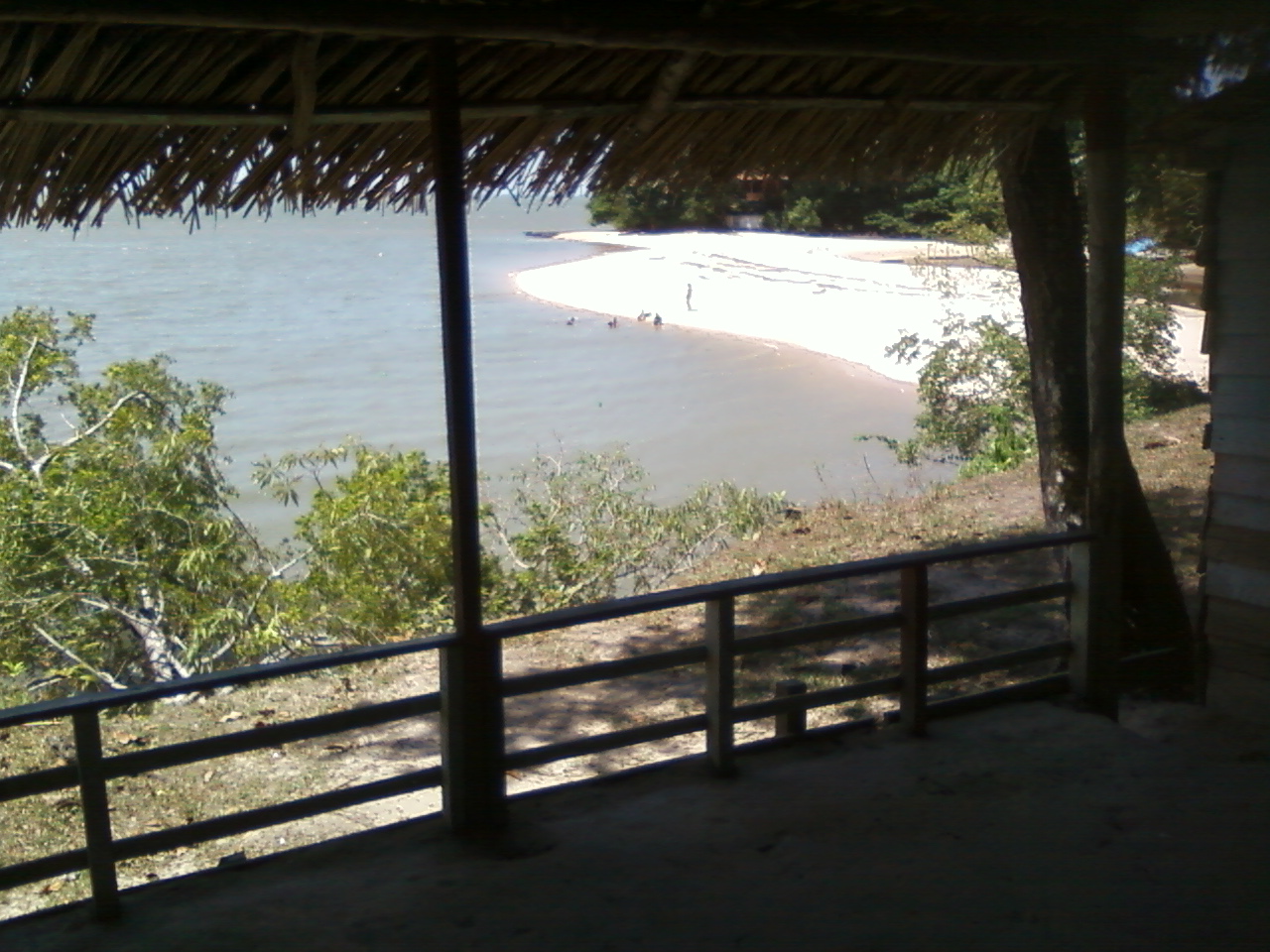


Shelter with a view to a small beach called Sossego

I walked along this beach, and another. The next one is called Praia funda (Deep beach). It’s really deep. The sand dunes slope down towards the water, like a tobogan. Because I was worried about the tide, I preferred to stride ahead. It had been about two hours now and the sun was really beating down. However, I was pleased with this parade of beaches, trails and forests before my eyes, along with the countryside atmosphere of an off-season and off-the-beaten-track hike. I must mention the smell of flours and fruits, along with tang of the Marajó Bay water.


Wednesday, August 10, 2016

0001 COTIJUBA ISLAND WEST COAST
PART 3
ARRIVING IN THE ISLAND

As I arrived, I climbed a metal ramp leading up to the covered way of a long pier. As I looked back from the structure, I took picture one, where you can see both types of boats serving the route. The larger and the smaller (the po-po-po).


 The larger boat docking at Cotijuba Island.
A po-po-po boat on the foreground and islands in the background
As I walked on the pier, I looked to my right and took another photograph. The tide was low and a po-po-po lay on the muddy shore. People unfortunately throw tires around! Or have they fallen off the boats?
Po-po-po boat on the southern shore of the Island

Anyway, I walked on. In the initial part of the island, you see the usual vendors, selling local dishes. One of them is the Tacacá, which is some sort of a soup, consisting of jambu (a native variety of paracress), tucupi (a broth made with wild manioc) and shrimps. The dish is served extremely hot in a half calabash. My lips burned with the pepper and the numbing effect of the jambu leaves. Then I set out for the walk.

Tuesday, August 9, 2016

0001 COTIJUBA ISLAND WEST COAST
PART 2
50-MINUTE RIVERBOAT RIDE ACROSS THE BAY

Once in the riverboat, culture interested tourists may have a close-range experience. The boats leave when all benches are occupied. Pará people tend to be spontaneous, friendly and talkative, and once somebody starts talking, others get in the conversation. One can hear the language, and accents. For some reason, such friendliness doubles towards foreigners. In general, people are interested in what sounds different, odd and out of the ordinary.
The po-po-po sets sail! It’s a small dot crossing a vast expanse of water, referred to as the Marajó Bay. Some large rivers end in this region, such as the Guamá River, and the Tocantins. For about 40-50 minutes, eyes witness the yellowish waters, past some large islands, and near the shore, where you see the Ribeirinhos, local people who live in pile dwellings. Such dwellings often have a small wooden pier reaching out into the river.

I have to remind you that I took the larger boat on this day!
0001 COTIJUBA ISLAND WEST COAST
PART 1
ANANINDEUA-BELÉM-ICOARACI BUS RIDE – ICOARACI PIER


I woke up early and rode the bus for about forty minutes, from Ananindeua to Belém, and then to Icoaraci, a district from the capital of Pará. That’s a 45-minute bus ride. Ananindeua is a city located in the metropolitan area of Belém. That’s when you arrive at a pier, where you can watch the busy routine of the merchants, fishers and marketers. Wooden riverboats arrive here with goods and products from the towns, river settlements and villages along the mighty rivers. Once at the quay, you can buy a boat ticket at a ticket box placed right by the pier. You pay around five reais and walk along concrete pier to it’s end  (142m). Then you get into a 10-15m-boat (called ‘pô-pô-pô’ in Portuguese, as a reference to the repetitive noise noise of it’s engine. If you want to take the larger boat, you pay a little less (it sounds strange at first) but the explanation is simple: the larger boat sails only once a day. It leaves at nine in the morning and returns at about five in the afternoon. The smaller ones leave at every half an hour or so.
STORY: 0001
TITLE: COTIJUBA ISLAND WEST COAST
PLACE: COTIJUBA ISLAND
DURATION: 3 HOURS
DISTANCE: 5 KM (APROXIMATELY)

LOCATION: 8 KM AWAY FROM BELÉM

                               creek past a dune in flexeira beach

Friday, August 5, 2016

Tuesday, July 19, 2016

AMTRA
AMAZON TRAILS
Presentation

walks, rides and trips in the Brazilian State of Pará

WHATS THIS BLOG ABOUT?
Its about trips , rides and walks
which I decided to take in Pará,
in Eastern Amazon, Brazil.

WHATS THESTATE OF PARÁ?
A state in northern Brazil,
in the easternmost part of the Amazon.
WHATS THE AMAZON?
A large area in northwestern Brazil,
mostly covered by rainforest, and
dominated by the Amazon River Basin.

WHATS THE AIM OF THE BLOG?
To share my travel experience and
call the worlds, attention to this region.

WHAT CAN I FIND ON THE BLOG?
Text stories, accounts of my experience                          
and adventure, and photographs of the land.

PERSONAL INTERESTS:
Speak in other languages;
interact with other cultures;
get to know other Brazilian states and other countries;
write songs and books;
share/exchange experiences;

HELP AND SUGGESTIONS:
All help and suggestions are welcome.
This is an initiative, not a whole project (at least yet).

WHERE AND WHAT IS THE STATE OF PARÁ? (BASIC FACTS)
The state is close to eastern mouth of the Amazon river
which flows out into the Atlantic Ocean.
The state of Pará is rather large, having 1,2 million km²
(twice as large as France).
The land is basically flat, altitudes are low
(were in the Amazon Basin!)
Climate is chiefly hot and humid
(you sweat like a pig, as they say)
Vegetation is lush, dense, and exuberant.
The rivers and creeks (here calledigarapés)
are endless,most of them unexplored.
Riverside beaches are also numerous.
The capital of the state is Belém, which is also where I live.
The city lies on a on the Guajará Bay,
which, along with the Marajó Bay,
constitutes a vast concourse of water all around.
Were on one of the entries to the Amazon river,
about 100 km or 62 miles upriver from the Atlantic.
These bays are part of the colossal Amazon river delta.
The largest part of the Delta lies across an island called Marajó
and is about 400 km or 248 miles away,
where the western arm of the river    meets the ocean.
The Marajó island is the centerpiece
of a vast archipelago. The island is 295 kilometers/183 mi long and 200 km (120 mi) across.
The area is 40.100 km² (15,500 mi²)
For a comparison, its about the size of Switzerland.
WHO AM I?

LANGUAGES I SPEAK:
Portuguese, English, Spanish,
Italian, French, German
Dutch, Esperanto, Catalan
and some Swedish.
Need to practice, certainly.

INVITATION:
Join us for this adventure! A hug on everybody and
LETS HIT THE AMAZON TRAILS!!!!!!