0001 COTIJUBA ISLAND WEST COAST
PART 4 TRAILS ALONG COTIJUBA ISLAND’S WEST COAST
(Saudade, Sossego and funda beach

Route along the west coast. Seven Beaches.
First, took the main lane to the west, and walked for
about five minutes. Then I reached the Farol beach, along which I walked
For 10 minutes, then along Amor beach for about five
minutes. The tide was coming and I took the trail which goes along the beach,
past some cottages, till I reached the Saudade beach, after almost two
kilometers. Then, I climbed down natural stairs and walked along the beach.
Halfway along, I saw fishing boats.

View back of Saudade
beach. Fishing boats
After that, I saw
another fishing boat on a sandbank. The tide was coming quick. There weren’t
much people, except for the fishers.
Although city people
are afraid of sting rays in the lagoons, fishers’ children run around and play
in the lagoons. There seem to be many myths about the island. Mind you, you can
spot bones of stings on the sand. It looks frightening for outsiders.

Fishing boat on the
sandbank. Tide coming quick!
Saudade Beach stretches for about
1.900 meters, slightly forming and arch. Behind the dunes, lie small creeks,
where fishers catch shrimp. There are also some mangroves, as well as small
ponds, some of them, almost inaccessible.

View ahead of the
final part of Saudade beach. Wild appearance
The final part of the beach is
narrow and stony. The beach is sided by a low-vegetation area, where trees are
aligned.

Stony patch near the
end of the beach
Some of the trees are
very close to the shore: an evidence that the tide is really in. The shadows of
these trees are nice for camping. One can put up his tent here and spend some
time.
However, I was so
curious, that I could hardly stop. I couldn’t wait to see what lies ahead!

View back at the
stony and final part of Saudade Beach

Northern end of saudade Beach. View
to the forest: a suitable place for camping!
At the end of Saudade
beach, I saw tumble-down wooden stairs.
They led to a trail
on the upper land. Because the tide was coming quick, I decided not to dare
going by the beach.
It was a real old set
of stairs. More of a natural, if anything!

Natural stairs
leading to the upper land

Partial view from the
top of the stairs. At the northern end of Saudade beach

And here’s me at the
top. In the background, final part of Saudade beach
Once on the upper
part, I could have a better view from Marajó Bay. It’s a large bay and you’ve
got Marajó Island, about fourty quilometers across. It takes some crossing! On
this weekday,
I hardly ever saw
anybody on my way, except for the eventual local person. Besides, it was about
mid-day, which is when most people are in their houses. People around here tend
to take a siesta at this time of they. They just tie their hammocks and fall
asleep, feeling the breeze and quiet. Anyway, I looked ahead and

View of a grove from the upper land.
I then followed the lane to the
north, past countryside houses, some of them, wooden ones. Most houses are
alone. People seem to come here more on weekends, or on a monthly basis.

View back of the northbound lane
along the west coast beaches
Wooden shack of a
local

As you walk further,
for a couple of meters, it becomes a walking trail. It also approaches the
shore and rises. Among the trees, you see mango trees, taperebá trees and
Brazil nut trees. The latter is rather tall! In the mango season, you can pick
up and eat a lot of them on the way. The same with the taberebá, a small yellow
fruit which results in a juice, which resembles the maracujá (passion fruit).
Taperebá is my
favorite, along with the maracujá and murici, all of them, yellowish juices!

Northbound trail
approaching the next beach
A couple more meters
further, and I reached a covered shelter, from which I could see another beach.
They call it Sossego beach. It’s also accessible by the main road that crosses
the island from south to north, up to the northernmost beach, called
Vai-quem-quer beach. Most holiday makers get a wagon, which looks like a
trolley, and is pulled by a tractor. It carries people for about 6 km, from the
southern pier to Vai-quem-quer beach.
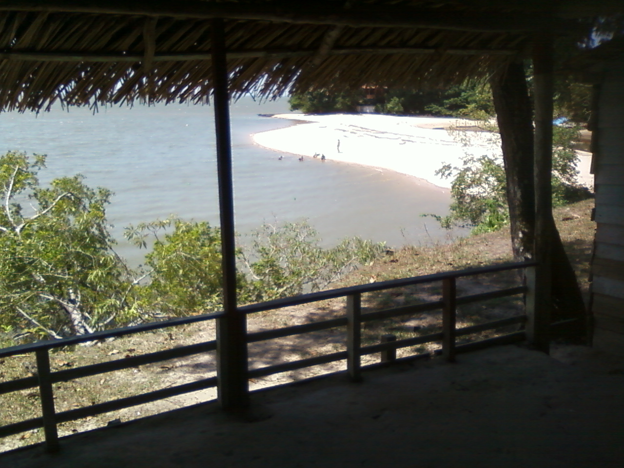
Shelter with a view
to a small beach called Sossego
I walked along this beach, and
another. The next one is called Praia funda (Deep beach). It’s really deep. The
sand dunes slope down towards the water, like a tobogan. Because I was worried
about the tide, I preferred to stride ahead. It had been about two hours now
and the sun was really beating down. However, I was pleased with this parade of
beaches, trails and forests before my eyes, along with the countryside atmosphere
of an off-season and off-the-beaten-track hike. I must mention the smell of
flours and fruits, along with tang of the Marajó Bay water.